The website has recently been updated with route descriptions of all five sections of the St Magnus Way. These not only give a detailed description of the route on two sides of A4 - thus easily printable and even laminated - but also give information on hazards to be aware of and places where we have applied for funding for improvements. The GPX files allow an accurate map of the route to be uploaded into mapping software on computer or smartphone. They work, for example, with the Ordnance Survey apps to give the route superimposed on Ordnance Survey mapping for detailed navigation.
Updated descriptions of all five sections of the St Magnus Way have been published, accompanied by GPX files that can be downloaded and used with mapping software.
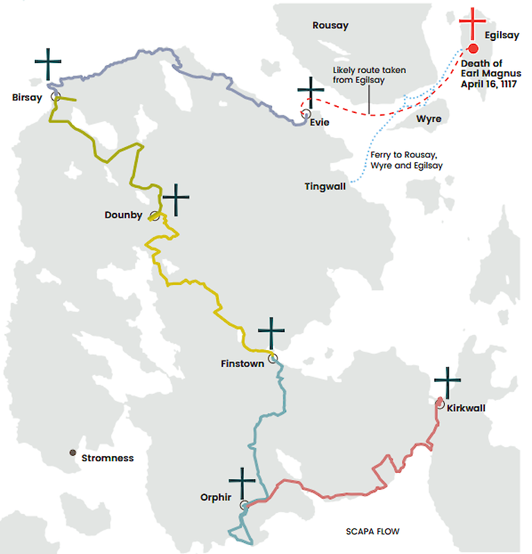
The files can be accessed through the resources section of our website but are included here as well, for ease of access.
- Evie to Birsay - route map, route description and GPS file for use with detailed mapping software.
- Birsay to Dounby - route map, route description and GPS file for use with detailed mapping software.
- Dounby to Finstown - route map, route description and GPS file for use with detailed mapping software.
- Finstown to Orphir - route map, route description and GPS file for use with detailed mapping software.
- Orphir to Kirkwall - route map, route description and GPS file for use with detailed mapping software.
We are keen to get feedback on the route and any problems encountered - please contact us.
Published on May 30th 2018